Sols 4386-4388: Powers of Ten
Earth planning date: Friday, Dec. 6, 2024 We successfully arrived in our new exploration quadrangle — the Altadena quad — which is named after a town on Earth very near our own Jet Propulsion Laboratory! The names from this quad will recognize the incredible interaction between Altadena and its surrounding environs with the San Andreas […]

3 min read
Sols 4386-4388: Powers of Ten
Earth planning date: Friday, Dec. 6, 2024
We successfully arrived in our new exploration quadrangle — the Altadena quad — which is named after a town on Earth very near our own Jet Propulsion Laboratory! The names from this quad will recognize the incredible interaction between Altadena and its surrounding environs with the San Andreas and other major faults, which led to the formation of several major mountain ranges, and with the rich human history of the area. The start of our activities in the Altadena quad was fairly typical, including observations both near to and far from the rover, depending on what catches our eye across the terrain. Today’s observations were no exception, but it strikes me that they fit into fairly neat order of magnitude bins that really crystallize how far-reaching (pun intended) Curiosity’s science is.
The nearest observation is of the rover itself, with MAHLI placed around 10 centimeters (about 4 inches) from its calibration target for a series of images tracking the amount of dust clinging to the target.
One meter (about 39 inches) from the front of the rover, MAHLI and APXS planned an analysis of a small float block, “Icehouse Canyon,” that resembled rocks we saw in Gediz Vallis. MAHLI, APXS, and ChemCam teamed up to analyze the DRT target located on typical bedrock in the workspace at “Sunland,” and ChemCam rastered across one the many veins in the workspace at target “Echo Mountain.” One meter (about one yard) in back of (and underneath) the rover, DAN scheduled multiple analyses that look to provide insight into water in the subsurface.
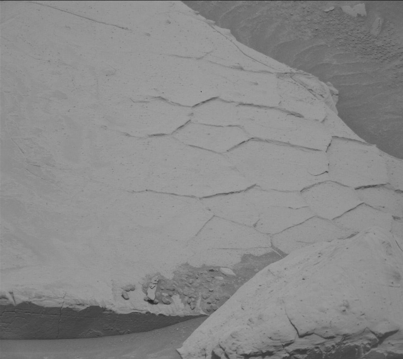
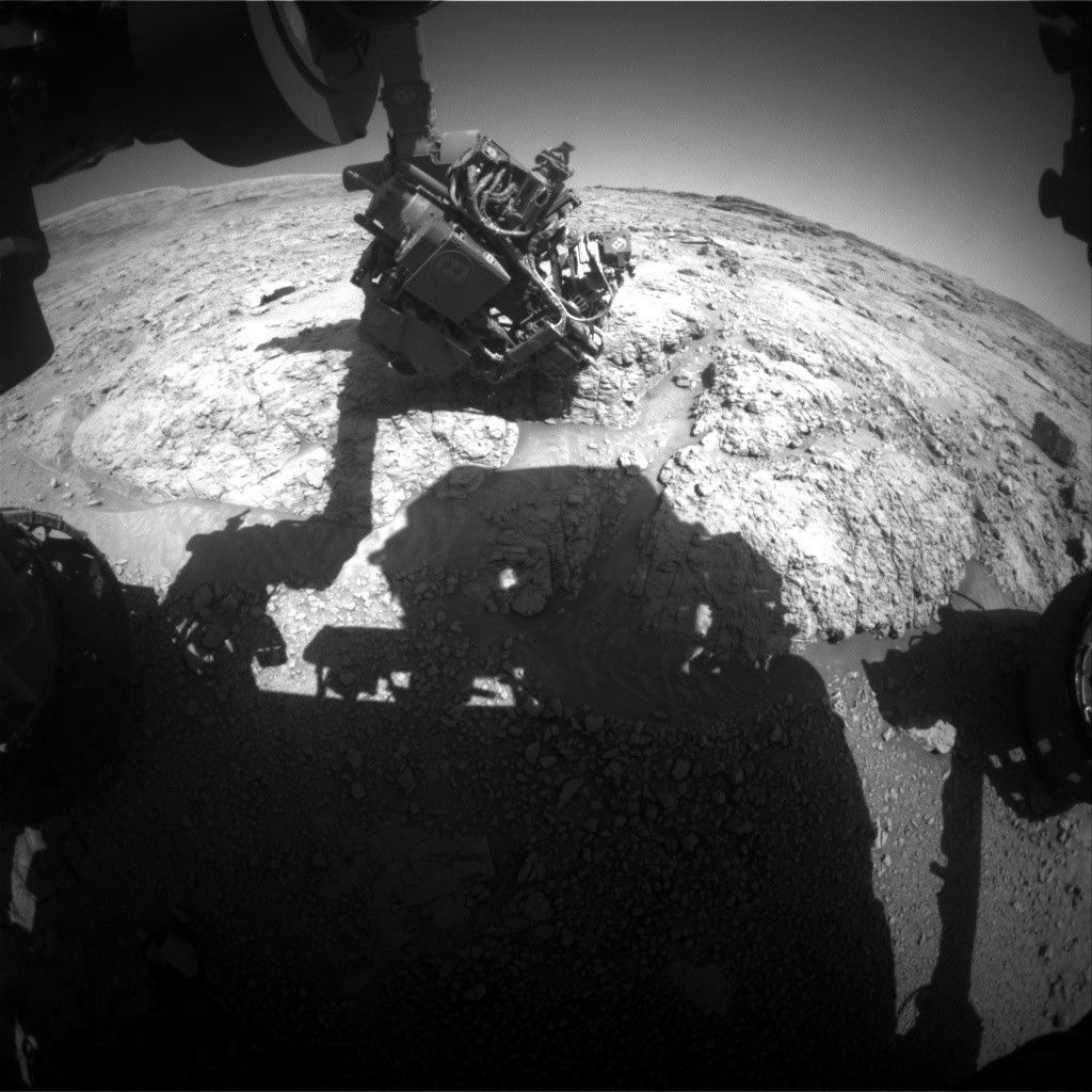
Tens of meters (tens of yards) from the rover, our interest in recording the many veins of this area continued. Mastcam planned three mosaics covering different collections of these long, linear features, some of which are visible in the lower left corner of the image above, to support study of their orientations.
Hundreds of meters from the rover, ChemCam looked back at Gediz Vallis, planning RMI mosaics of materials on both Gediz Vallis Ridge and within Gediz Vallis itself. The mosaics add more insight to that which we gained as we traversed through Gediz Vallis as the team tries to interpret the formation of the ridge and valley. Mastcam added coverage of this same area and extended their imaging a bit farther to include a small crater, “Grant Lake,” well south of the rover.
Thousands of meters from the rover (five-eighths of a mile, and beyond), ChemCam acquired a mosaic of the wind-sculpted structures that cap Mount Sharp, known as yardangs.
Finally, gazing up into the Martian atmosphere that extends tens of thousands of meters into space (6 miles, and multiples beyond that), Navcam planned early morning and midday imaging to assess the amount of dust in the atmosphere and search for clouds and dust devils. ChemCam planned a passive sky observation to measure certain chemical compounds in the atmosphere, and REMS and RAD included their regular schedule of weather and radiation monitoring, respectively.
The weekend plan is truly science across the scales!
Written by Michelle Minitti, Planetary Geologist at Framework
Share
Details
Related Terms
What's Your Reaction?


.jpg?#)





.JPG?w=1024&h=1024&fit=clip&crop=faces%2Cfocalpoint)
