Science Activation’s PLACES Team Facilitates Third Professional Learning Institute
The NASA Science Activation program’s Place-Based Learning to Advance Connections, Education, and Stewardship (PLACES) project supports middle and high school educators to engage students in data-rich Earth science learning through the integration of NASA data sets, images, classroom lessons, and other assets. This project draws on a place-based approach as a means to increase “data […]
5 min read
Science Activation’s PLACES Team Facilitates Third Professional Learning Institute
The NASA Science Activation program’s Place-Based Learning to Advance Connections, Education, and Stewardship (PLACES) project supports middle and high school educators to engage students in data-rich Earth science learning through the integration of NASA data sets, images, classroom lessons, and other assets. This project draws on a place-based approach as a means to increase “data fluency” — the ability and confidence to make sense of and use data. This means knowing when, how, and why to use data for a specific purpose, such as solving problems and communicating ideas grounded in evidence.
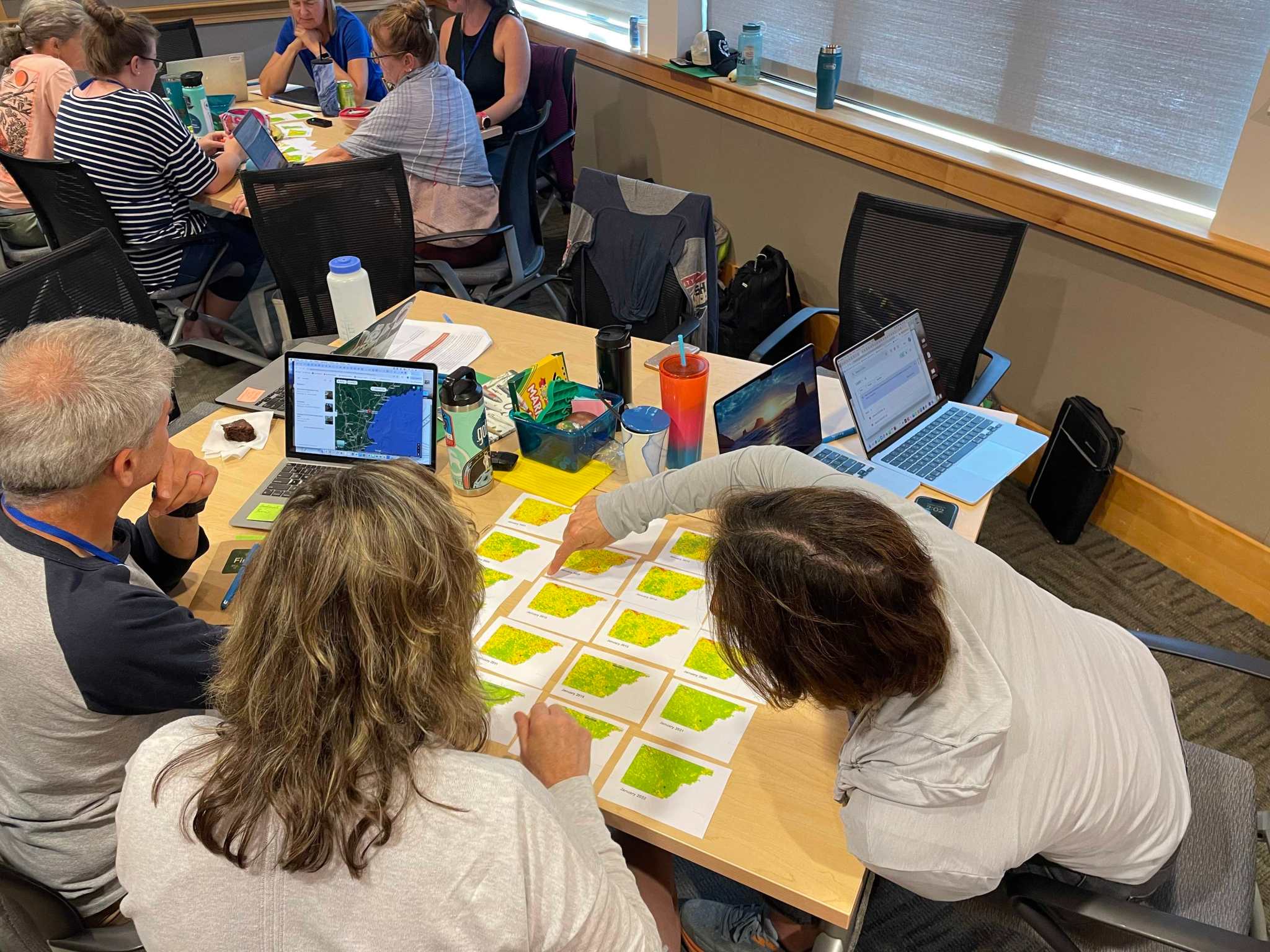
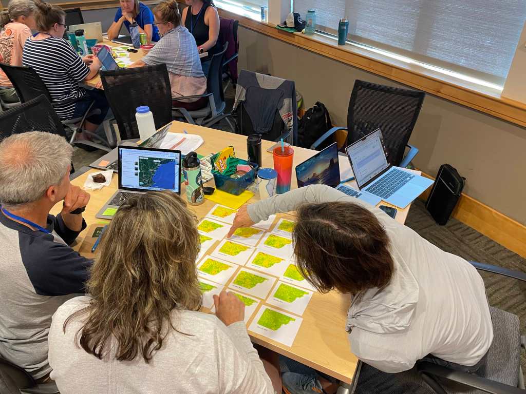
As part of this effort, PLACES facilitated its third Professional Learning (PL) Summer Institute (SI) for 22 educators at the Gulf of Maine Research Institute (GMRI) in Portland, Maine the week of August 12th, 2024. This is the third PL Summer Institute the PLACES team has facilitated, each focusing on engaging educators in place-based, data-rich teaching and learning with NASA data and resources.
The GMRI PL development and facilitation was a collaborative co-design effort between two NASA Science Activation projects (PLACES led by WestEd and the Learning Ecosystems Northeast project led by GMRI) and colleagues from the Concord Consortium and NASA Langley Research Center. During this PL, teachers took part in community science projects developed by GMRI to incorporate youth in ongoing research projects, including a mix of field- and classroom-based experiences that explored the phenomena of Hemlock Woolly Adelgid (HWA) and the changes to intertidal crab populations – two invasive species that are proliferating as a result of climate change. During two field-based experiences, teachers gathered primary data using protocols from GMRI’s Ecosystem Investigation Network and the NASA-sponsored program, GLOBE (Global Learning and Observations to Benefit the Environment). Teachers then explored these primary data using Concord Consortium’s Common Online Data Analysis Platform (CODAP) to better understand the geographic and temporal spread of these species. To connect their local experiences to global happenings, teachers then explored secondary data sets, including those sourced from the My NASA Data (MND – also supported by NASA Science Activation as part of the GLOBE Mission Earth project) Earth System Explorer (e.g., Normalized Difference Vegetation Index, salinity, sea surface temperature). The facilitation team also used the MND Data Literacy Cubes to encourage teachers to consider a multitude of diverse questions about place, data, and the phenomena. The GLOBE protocols supplemented existing GMRI data collection protocols, presenting new opportunities for teachers already experienced with HWA and Green Crabs. The MND data and Data Literacy Cubes moved teachers from questions they generated as part of their primary data collection towards new knowledge.
Daily feedback from teachers highlighted their appreciation for the responsiveness of the facilitation team, as well as a growing curiosity and desire for using NASA resources such as protocols from GLOBE and data from MND’s Earth System Explorer. This is exciting to see as the teachers transition from the Summer Institute into a virtual Community of Practice during the school year. The Community of Practice engages them in peer-to-peer collaboration and dialogue as they develop, test, and give feedback on their own place-based, data-rich experiences using NASA data and resources. So far, teachers are planning to tackle a variety of topics ranging from ocean chemistry to human connections to the environment. Teachers indicated their interest in “making place-based experiences meaningful to our unique populations of students and having cultural representation in the classroom,” and focusing on “cross-school collaboration.” Preliminary evaluation data indicated that 76% of teachers thought their experiences with NASA resources during the SI helped them identify ways to bring data into their classroom. 85% of teachers indicated they feel a greater connection to NASA and knowledge of NASA resources for enhancing student understanding and engagement in science. Moving into the fall, teachers will take part in a Community of Practice, where they will work to implement a place-based, data-rich moment in their individual classrooms. In the summer of 2025, teachers will take part in a second summer institute where they will continue to learn more about implementing place-based, data-rich instruction.
The PLACES GMRI Summer Institute was made possible by a large co-design, collaborative effort across our partner organizations. This included:
- Facilitation Team: Catherine Bursk (GMRI), Meggie Harvey (GMRI), Sara Salisbury (GMRI), Daniel Damelin (Concord Consortium)
- In-person Facilitation Support Team: Leigh Peake (GMRI), Karen Lionberger (WestEd), Kristin Hunter-Thomson (Dataspire), Angela Rizzi (NASA Langley)
- In-Person Team Member Participants: Janet Struble and Kevin Czaikowski (GLOBE, University of Toledo), Svetlana Darche (WestEd)
- Virtual Observers: Kirsten Daehler, Nicole Wong, Leticia Perez (WestEd), Tracy Ostrom (GLOBE, UC Berkeley), Lori Rubino-Hare (NAU)
- Additional support: Frieda Reichsman (Concord Consortium), Barbie Buckner and Jessia Taylor (NASA Langley), Sean Ryan (NAU), Lauren Shollenberger (NAU)
PLACES is supported by NASA under cooperative agreement award number 80NSSC22M0005 and is part of NASA’s Science Activation Portfolio. Learn more about how Science Activation connects NASA science experts, real content, and experiences with community leaders to do science in ways that activate minds and promote deeper understanding of our world and beyond: https://science.nasa.gov/learn
Share
Details
Related Terms
What's Your Reaction?








.jpg?#)


