


.jpg?#)


Old Data Yields New Secrets as NASA’s DAVINCI Preps for Venus Trip
How NASA’s DAVINCI mission to Venus uses old data to reveal new secrets.
Due to launch in the early 2030s, NASA’s DAVINCI mission will investigate whether Venus — a sweltering world wrapped in an atmosphere of noxious gases — once had oceans and continents like Earth.
Consisting of a flyby spacecraft and descent probe, DAVINCI will focus on a mountainous region called Alpha Regio, a possible ancient continent. Though a handful of international spacecraft plunged through Venus’ atmosphere between 1970 and 1985, DAVINCI’s probe will be the first to capture images of this intriguing terrain ever taken from below Venus’ thick and opaque clouds.
But how does a team prepare for a mission to a planet that hasn’t seen an atmospheric probe in nearly 50 years, and that tends to crush or melt its spacecraft visitors?
Scientists leading the DAVINCI mission started by using modern data-analysis techniques to pore over decades-old data from previous Venus missions. Their goal is to arrive at our neighboring planet with as much detail as possible. This will allow scientists to most effectively use the probe’s descent time to collect new information that can help answer longstanding questions about Venus’ evolutionary path and why it diverged drastically from Earth’s.
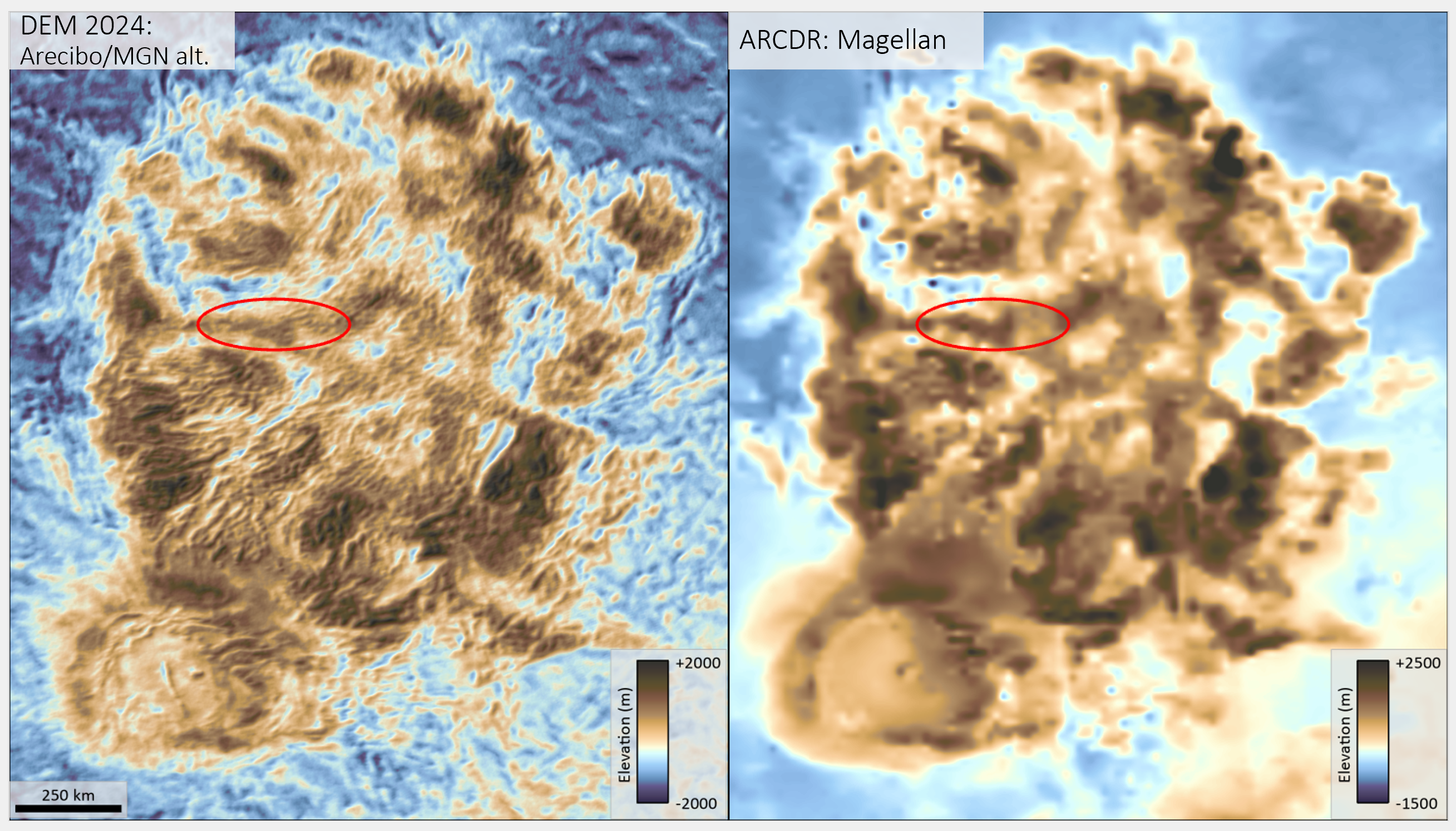
Between 1990 and 1994, NASA’s Magellan spacecraft used radar imaging and altimetry to map the topography of Alpha Regio from Venus’ orbit. Recently, NASA’s DAVINICI’s team sought more detail from these maps, so scientists applied new techniques to analyze Magellan’s radar altimeter data. They then supplemented this data with radar images taken on three occasions from the former Arecibo Observatory in Puerto Rico and used machine vision computer models to scrutinize the data and fill in gaps in information at new scales (less than 0.6 miles, or 1 kilometer).
As a result, scientists improved the resolution of Alpha Regio maps tenfold, predicting new geologic patterns on the surface and prompting questions about how these patterns could have formed in Alpha Regio’s mountains.
Benefits of Looking Backward
Old data offers many benefits to new missions, including information about what frequencies, parts of spectrum, or particle sizes earlier instruments covered so that new instruments can fill in the gaps.
At NASA Space Science Data Coordinated Archive, which is managed out of NASA’s Goddard Space Flight Center in Greenbelt, Maryland, staff restore and digitize data from old spacecraft. That vintage data, when compared with modern observations, can show how a planet changes over time, and can even lead to new discoveries long after missions end. Thanks to new looks at Magellan observations, for instance, scientists recently found evidence of modern-day volcanic activity on Venus.
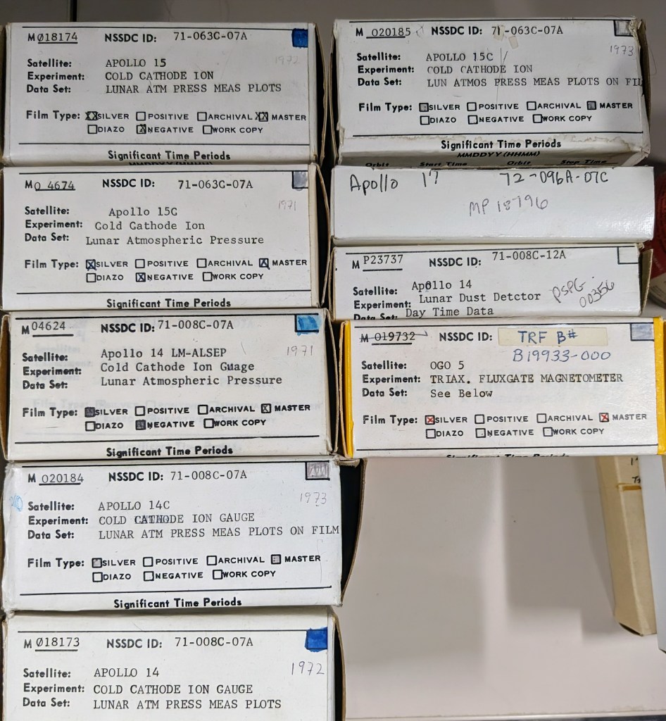
Magellan was among the first missions to be digitally archived in NASA’s publicly accessible online repository of planetary mission data. But the agency has reams of data — much of it not yet digitized — dating back to 1958, when the U.S. launched its first satellite, Explorer 1.
Data restoration is a complex and resource-intensive job, and NASA prioritizes digitizing data that scientists need. With three forthcoming missions to Venus — NASA’s DAVINCI and VERITAS, plus ESA’s (European Space Agency) Envision — space data archive staff are helping scientists access data from Pioneer Venus, NASA’s last mission to drop probes into Venus’ atmosphere in 1978.
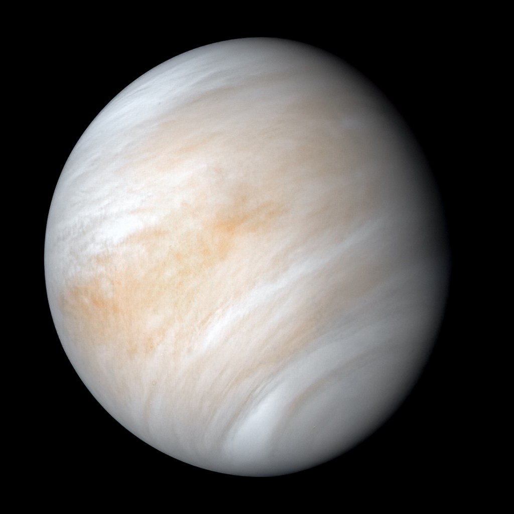
Mosaic of Venus
Alpha Regio is one of the most mysterious spots on Venus. Its terrain, known as “tessera,” is similar in appearance to rugged Earth mountains, but more irregular and disorderly.
So called because they resemble a geometric parquet floor pattern, tesserae have been found only on Venus, and DAVINCI will be the first mission to explore such terrain in detail and to map its topography.
DAVINCI’s probe will begin photographing Alpha Regio — collecting the highest-resolution images yet — once it descends below the planet’s clouds, starting at about 25 miles, or 40 kilometers, altitude. But even there, gases in the atmosphere scatter light, as does the surface, such that these images will appear blurred.
DAVINCI scientists are working on a solution. Recently, scientists re-analyzed old Venus imaging data using a new artificial-intelligence technique that can sharpen the images and use them to compute three-dimensional topographic maps. This technique ultimately will help the team optimize DAVINCI’s images and maps of Alpha Regio’s mountains. The upgraded images will give scientists the most detailed view ever — down to a resolution of 3 feet, or nearly 1 meter, per pixel — possibly allowing them to detect small features such as rocks, rivers, and gullies for the first time in history.
“All this old mission data is part of a mosaic that tells the story of Venus,” said Jim Garvin, DAVINCI principal investigator and chief scientist at NASA Goddard. “A story that is a masterpiece in the making but incomplete.”
By analyzing the surface texture and rock types at Alpha Regio, scientists hope to determine if Venusian tesserae formed through the same processes that create mountains and certain volcanoes on Earth.
NASA’s Goddard Space Flight Center, Greenbelt, Md.
Share
Details
Related Terms
What's Your Reaction?