


.jpg?#)


Sols 4502-4504: Sneaking Past Devil’s Gate
Written by Michelle Minitti, Planetary Geologist at Framework Earth planning date: Friday, April 4, 2025 We continue to make progress driving up Mount Sharp, each day gaining new perspectives on the spectacular, towering buttes surrounding our path. To get to the next canyon we can ascend, we have to swing around the north end of […]

3 min read
Sols 4502-4504: Sneaking Past Devil’s Gate
Written by Michelle Minitti, Planetary Geologist at Framework
Earth planning date: Friday, April 4, 2025
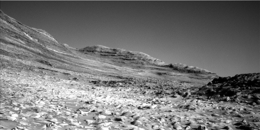
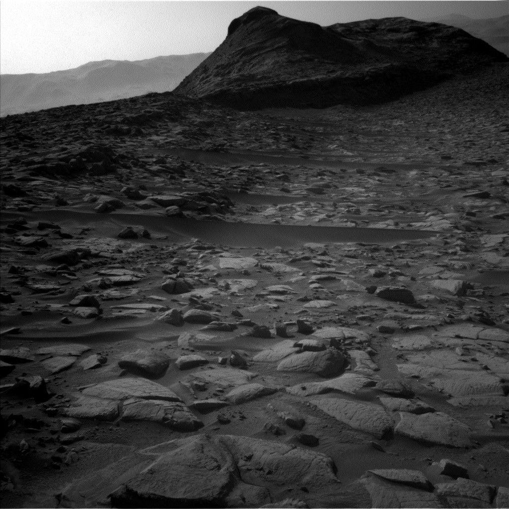
We continue to make progress driving up Mount Sharp, each day gaining new perspectives on the spectacular, towering buttes surrounding our path. To get to the next canyon we can ascend, we have to swing around the north end of a small ridgeline, “Devil’s Gate,” which is on the right side of the image above.
The blocks scattered around the base of Devil’s Gate are ripe with interesting structures, which motivated the acquisition of an RMI mosaic across the ridge. Those blocks are also inconvenient for driving and parking the rover with all six wheels firmly on the ground, the latter of which is needed to be able to unstow the arm for APXS and MAHLI observations. Our last drive ended with our front wheels not quite on solid ground, so we had to forego arm work this weekend. But as you can imagine with the view around us, Devil’s Gate was not the only feature that the team was excited to image. ChemCam added a second RMI mosaic along the base of “Texoli” butte, which you can see the flank of on the left side of the image above. Mastcam planned a mosaic across an expanse of bedrock that looks like rolling waves frozen in place at “Maidenhair Falls.”
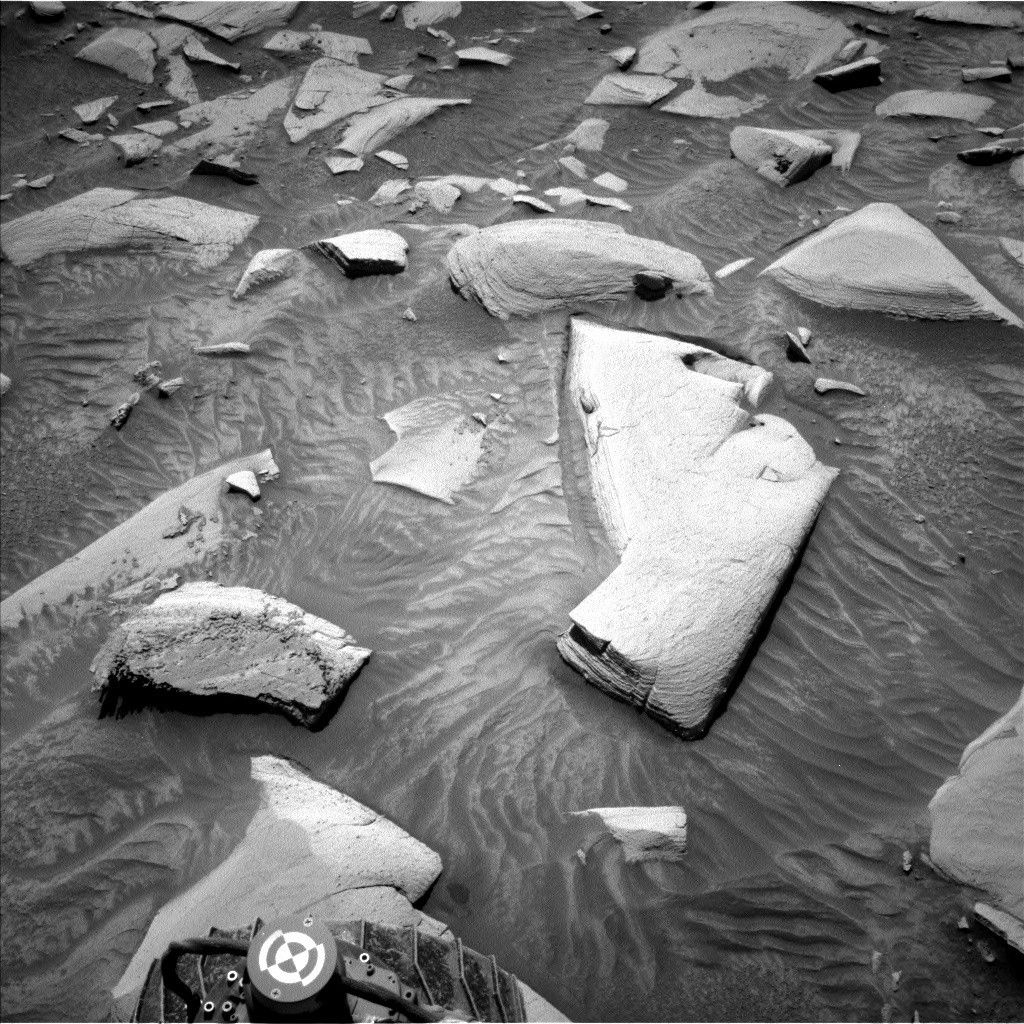
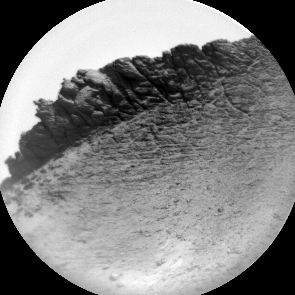
The rocks right in front of the rover were also wonderfully complex in their textures and structures. ChemCam targeted two different textures expressed in the workspace — one across fine layers at “Arroyo Burro” and one across rough, platy, and gray material at “Arroyo Conejo.” Mastcam documented the block containing both these targets with a stereo mosaic that will give us a three-dimensional view of its structures.
We planned a drive to get us further around the base of Devil’s Gate, after which we will acquire an autonomously-targeted ChemCam LIBS raster and early morning Navcam and Mastcam mosaics looking back on the path we have recently traveled. DAN is scheduled for about seven hours of data collecting across the plan, both during science blocks and our drive. The sky gets a lot of attention in this plan with suites of observations taken at two different times — near midday and early morning — to assess variability across the day. Each window of time had Navcam dust-devil and cloud movies, and measurements of the amount of dust in the atmosphere. The early morning block of observations also had multiple cloud movies cover the full sky. REMS and RAD have regular measurements across the sols.
See you Monday, when we are a bit farther past Devil’s Gate!
Share
Details
Related Terms
Explore More


What's Your Reaction?